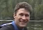
"I've snowshoed and canoed thousands of
miles patrolling and there isn't a lake in
all of Quetico that I haven't been on."
(See: Boundary Waters Journal Fall 2000:
"The Original Quetico Ranger")
"I was finally able to begin this pursuit-73
years after his (Grandpa Art Madsen)
first trip into the Quetico..."
For
the past 25 years, while visiting my grandparents during the summers on
Lake Saganaga, I have heard many of my grandfather's stories. And
having heard these stories, it created a desire to explore the
wilderness of the Quetico Provincial Park that he had patrolled as one
of the Park's original sixteen rangers. My grandfather, Art Madsen,
helped lay the foundation for Quetico's vast region of one million
acres. As he said, "I've snowshoed and canoed thousands of miles
patrolling and there isn't a lake in all of Quetico that I haven't been
on." (SEE: Boundary Waters Journal Fall 2000: "The Original Quetico
Ranger")
I
had been waiting to begin my quest of retracing my grandfather's past
into Quetico, and this past fall, I was finally able to begin this
pursuit-73 years after his first trip into the Quetico-now considered
the most extensive canoe region remaining in the world.
I
assist my grandmother, Virginia "Dinna" Madsen operating her wilderness
resort on Saganaga Lake that my grandfather established in 1931 and
named it "Sagonto" (SAGanaga - ONTariO).
Big
Saganaga Lake (also known as "Sag") is approximately 20 miles long and
20 miles wide with 300 islands heavily forested with virgin pine. It is
situated in a uniquely divided international park system shared by the
United States and Canada. Saganaga Lake comprises four parks with the
majority of the lake placed in Canada. The Superior National Forest and
the BWCAW (Boundary Waters Canoe Area Wilderness) lie on the U.S. side.
On the Canadian side of Sag begins the Quetico Provincial Park on the
western end. And the remainder of the lake is part of La Verendrye
Provincial Park, in the area where I assist my grandmother.
"This 64 mile-round trip, crossing 8 to 10 lakes
and over 17 portages each way, plus several
carryovers and many rapids-packing my kayak
and gear weighing 110
pounds
together
is a strenuous four-day trip under
normal
weather conditions, but my challenge was
to do it solo in two days."
My
first expedition into the Quetico was to begin at the Park's
southeastern corner, and travel the BWCAW/Quetico border in a
southwesterly direction. First crossing Big Saganaga Lake, Zephyr,
Swamp, Cypress or "Ottertrack", Little Knife, Big Knife, Carp, and
Birch Lakes as far as the ranger station at Prairie Portage which
connects into Basswood Lake. On the return, I decided to head a bit
farther north from Knife Lake into an unusually difficult, remote route
into Carp, Emerald and Plough Lakes before re-entering Cypress.
This
64 mile-round trip, crossing 8 to 10 lakes and over 17 portages each
way, plus several carryovers and many rapids-packing my kayak and gear
weighing 110 pounds together-is a strenuous four-day trip under normal
weather conditions, but my challenge was to do it solo in two days.
The 2002 summer season was too busy to embark on this solo trip, but I finally found time in early September. With
the water temperature dropping to unsafe levels, I didn't want to delay
any longer. Should I capsize due to rough waters-as canoeists and
kayakers know of the dangers of hypothermia in the cold fall. For
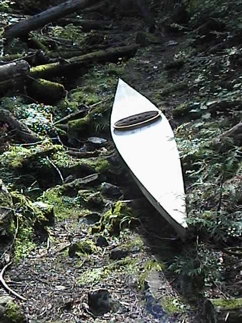
maximum speed, instead of a canoe, I decided to use my kayak that I had
constructed two years earlier.
Wednesday,
September 4, 2002: I began gathering and packing for the trip. The next
step was to lay out, organize and eliminate non-essential items that
would be too bulky to fit into the confines of the kayak. The essential
equipment: An 80 lb. hand-made East Coast Greenland Inuit-style kayak
and hand-made paddle of the same genre. Navigation aids: compass (used
at night); for a communication/weather report, a 5-watt handheld marine
radio; Seal-Line dry bag; peanut butter/honey 10 oz total; Swedish
Siljan flatbread; non-sulfured dried apricots and dried pineapple (high
in natural sugars); honey sweetened graham crackers; personal
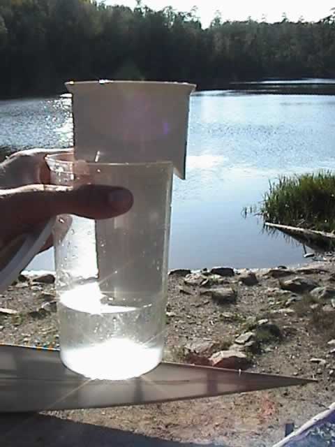
pint-sized Brita filter; a change of clothes; foam bed roll (which
doubles as my paddling cushion); and a roll of duct tape-to patch up
the kayak in a pinch, or myself if the need arose. I packed all
necessary items which were water sensitive, including a compact digital
video/still camera, into the
dry bag.
"It was dark and silent, as I rolled
my kayak into the still water..."
I
planned to leave in the dark of the morning, to maximize the daylight
traveling time, as well as to reach the Cache Bay Ranger station on
Saganaga at the 8:00 a.m. opening time, and departing the station as
soon after as possible. Before 5:00 a.m., September 5, 2002, I dressed
in a shirt and shorts, then put on my shorty wetsuit and lifejacket and
sandals. I checked my dry bag's contents once more, then as a last
minute thought, I grabbed a large black, plastic trash bag and packed a
zippered fluorescent, hood-pouch rain suit, large-covering mosquito
netting, and a pair of light sweatpants, shirt and shorts.
It
was dark and silent, as I rolled my kayak into the still water, then
loaded all my gear in the aft space behind the cockpit. I smiled for a
self-photo with a night-vision setting on my camera, which I stowed
along with my sandals. All my gear just fit, leaving room for the
pilot, navigator, and propulsion unit-me.
Shifting
my weight to sit perfectly in the middle, I think back about a week,
with gratitude, to the private Eskimo-rolling lessons given to my
sister and me by a kayaker who summers at the lake. Before the lessons,
I could exit my kayak and wasn't afraid of getting wet, but I was
actually wary of it, as I wanted to have the security of knowing how to
roll 180 degrees-from having my head pointing down under the water to
rolling back upright.
"A few angled flicks of the slim, tapered, non-feathered paddle sent me shooting forward and away
from the dock and
front bay and
out to cross into the open
water at 5:08 a.m."
Pushing
away from the dock, I reached out with my paddle and braced a couple of
strokes-a back and forth feathering-like motion while leaning to the
side of the submerged paddle, to loosen up and check my weight and
balance and seaworthiness of the kayak and paddle-as well as to boost
my confidence. A few angled flicks of the slim, tapered, non-feathered
paddle sent me shooting forward and away from the dock and front bay
and out to cross into the open water at 5:08 a.m.
Having
traveled on the lake in the dark by boat many times before, I have
learned to memorize the silhouettes of the islands and shoreline, but
this was a direction I had not before traveled in the dark. Heading in
the general correct direction was not a concern, however just ahead
lies an area of the Boundary Waters, west of the motor access corridor,
which I had never paddled. The islands convolute and create bays and
hidden passages which are not discovered until paddling in a ways. I
found it takes a certain intuition, even if one has a map, to avoid the
fatigue that occurs by investigating every bay and passage to find a
way through a chain of islands or to exit a lake.
"Alone
crossing the wide expanse on the "Big Lake" of Saganaga in the early
dark of dawn, knowing that I am not far from the area of the lake where
the depth reaches 284 feet-created a heart thumping, exhilarating
challenge."
Relying
on a sense of direction, I made my way past several small islands until
I discovered I had entered a bay with an island immediately ahead. This
island was blocking from view what was to be the joining of the island
to my right and left. Having kept a steady pace on the paddle, I paused
mid-stroke to consider the dark, obscure shoreline and the situation.
Do I continue ahead and find I have to disembark and portage? (Entering
or exiting a kayak is more time consuming than a canoe.) Do I paddle
around this supposedly large island? I chose to investigate ahead and
found I could see water beyond some exposed rocks, which I had assumed
were blocking my passage. "Oh no!" I thought, "I have to get out
already?" Fully expecting this, it was not until a few yards from
contact with the nearest rocks that I discovered a narrow, shallow
water passage through the rocks. Whew! Two islands passed on either
side, and the view opened out into what is known as the "Big Lake" on
Sag.
Only a
half-mile from Quetico's boundary, and from there three to four miles
left to paddle before I reach the Cache Bay Ranger Station. The rest of
the way to Cache Bay passed quickly in thought as the scenery was very
familiar from this summer, having paddled friends and guests down to
see the treasured Indian pictographs and the thundering Silver Falls on
multiple occasions. Alone crossing the wide expanse on the "Big Lake"
of Saganaga in the early dark of dawn, knowing that I am not far from
the area of the lake where the depth reaches 284 feet-created a heart
thumping, exhilarating challenge.
At 7:20 a.m., I arrived at the Cache Bay Ranger Station. It was turning
out to be a fine day, and the paddling was superb with calm waters. A
slightly overcast sky was welcome to the eyes and skin. Awaiting the
office to open, I sat and had a snack of dried pineapple and apricots
for breakfast.

Cache Bay Ranger Station
(from Sagonto photo archives)
Exactly
at 8:00 a.m., I was at the office door and knocked. Ranger Janice
Matichuk came to the door and looked at me in disbelief, and said she
had just taken a look at the dock and had not seen anyone. I had
beached on the far side of the dock, which happened to be out of
view-the only place to exit a kayak safely. She invited me in and asked
how my family was, and then inquired if I was just down for another day
paddle around Cache Bay. I told her my intentions of paddling to
Prairie Portage and returning the next day. She thought about it and
said it could be done under normal weather conditions and winds. She
happened to have an extra copy of the master Quetico map for me to take
on my trip, which she marked with estimated distances and points of
interest as well as land formations to mark entry and exit points.
Janice
informed me that a friend of hers, Andrea Allison, who is the librarian
at Quetico Park Headquarters on French Lake, at Dawson Trail, Ontario,
was at Prairie Portage for one more day. Andrea is one of whom who has
transcribed and chronicled much information on my grandfather for the
Quetico Park. I said I would be glad to meet her, once I arrived at my
destination. She radioed down to Prairie Portage and
alerted Andrea of my expected arrival that evening. She said Andrea
would have a place for me to sleep that night and I happily accepted.
Nine a.m. arrived and I had to be on my way. I then started out again
with an imagined reality of what was to come before me.
As I beached at my first portage, I enjoyed the sight of two playful
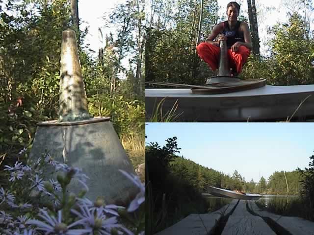
otters on Zephyr Lake. This first portage was an easy carryover into the small Swamp Lake. Then the challenge of the ¾ mile Monument Portage-a steep incline halfway across. I reached the summit of Monument at 10:03 a.m., and took time to greet canoeists at the other side.

Paddling into my next lake, Cypress, also known as "Ottertrack Lake", I was able to view the memorial plaque with a portrait etching of the legendary Benny Ambrose for the first time. It had been crafted and mounted on the "Ottertrack Cliff" by John Bouchard,
a former game warden on Sag. "Ottertrack Cliff" appears to have the
prints of an otter on the side of the shear cliff.
"The winds picked up, and I had a battle
on my hands-I estimated at 25 knots... Persevering against heavy
headwinds, fatigue began to set in-more mental than physical. I had
thoughts of turning back...
Pulling harder, my kayak sliced through and pulled forward. This long and narrow lake seemed to stretch on and on. "

Day #1 - 3:31pm - 1/3 way down Knife lake -
break from 25knot winds - thoughts of turning back
- fatigue setting in and just a little depressed about
the lack of progress and slow moving shore.
Ben and my grandfather had been the closest of friends and comrades since they met in 1931. I was just a baby the last time I had been on Ottertrack Lake when my parents and grandparents were visiting Benny and staying at his homestead, which had been just across the lake on the adjacent cliff from his memorial plaque.
When I arrived at Little Knife portage, I had a snack and lay down to rest for ten minutes. From Little Knife, there was a narrow water passage through rocks into Big Knife Lake.
The
winds picked up, and I had a battle on my hands-I estimated at 25
knots. Big Knife Lake is narrow and very long, allowing the wind to
gain much speed. Persevering against heavy headwinds, fatigue began to
set in-more mental than physical. I had thoughts of turning back.
One-third of the way down Knife Lake, I took a break at 3:31 p.m.,
hoping the wind would subside. An hour later the wind was as strong as
ever, so I gathered my gear together after a snack and rest and
departed into the face of the wind, having to paddle twice as hard as
before to make any headway. My progress was minimal-I had my eyes on
the shore which was moving slowly behind. Pulling harder, my kayak
sliced through and pulled forward. This long and narrow lake seemed to
stretch on and on.
Each
time I would glance at the small-scale map in the plastic zipper bag, I
would try to use pilotage and identify a rare point of land, only to find that one point looked like another, and I began to misjudge my progress. Once I thought I had progressed two-thirds down Big Knife, when I had, in reality, just barely splashed my paddle through one third of the way. There was no time to paddle within view of the "Rootbeer Lady's Island".
I
finally arrived at Big Knife portage! After the wind battle, I was not
up to a long portage, so I opted to wade the rapid. One rapid-I thought-flat water, then another rapid! There was no way I could see to cross through the thick undergrowth to join with the portage, so I continued on the water route-actually losing count of the many rapids between Knife and Carp Lakes. I waded through the shallow, lightly flowing rapids and hopped on the back of my kayak to float to the next rapid, once the water smoothed out. Attempting to sit on the back of my stiletto kayak took more skill than I would have guessed-balancing precariously, sitting on the reinforced deck lathe behind the cockpit, I would brace more than paddle to maintain my vertical, trembling
position and drift with the current. With feet trailing in the water on
either side, I would stand up once reaching the next rapids, and begin wading again. Halfway down the series of rapids and flat water I spied a stick protruding from the water, with something perched on top which I could not identify. As I passed, to my right and behind, what was on top came to life-a medium sized, painted turtle! which splashed into the water and out of sight.
"I advanced ahead and gingerly placed
my sandaled feet among the slippery, jagged rocks,
in hopes of preventing injury in
the swift current."
The opening doubled in width, then continued into a channel that ran at an angle from my right. I advanced ahead and gingerly placed my sandaled feet among the slippery, jagged rocks, in hopes of preventing injury in the swift current. Down another rapids and at the end-this time I got in the kayak and paddled on for a short while until I found the way narrowed and disappeared out of sight. A falls!
I
exited and carried the kayak over the smooth-rocky terrain, which would
supposedly be submerged during high water. Setting the kayak down in
the current, I had no choice but to enter the kayak in the shallow
water as no shoreline was available. As always, I used my paddle as a
lever, sitting on one end on the deck lathe behind the cockpit and the
other resting on a rock at an angle lower than the kayak which would
become approximately level when my full weight is put upon the kayak.
Feet swing to the deck and I remove my sandals, wipe each foot, stow
the towel, and slide carefully into the opening, which is made to fit
me, but is so snug that I practically have to move my kneecaps around
to slip forward under the masik in lieu of hyper extending my knees.
It was then getting dark, and the sun was now below the trees. I had trouble finding the portage P264 from Carp Lake to Birch Lake. After numerous rapids and a couple carryovers, portages were getting "old", so I believed that I had crossed over P264 already.
"Mustering
my will, I paddled a third time around the point and to the end of the
bay where I found the blind channel and my final portage-the portage to
Birch!. Never was I so glad in my life to see a portage!"
I viewed the compass to double-check my position. Trying to get my bearings, I looked around and spotted islands to the north and a channel that went out of view to the south, and a point with a bay beyond-ahead of me. From this configuration, I figured I was nearing my final portage which would be around the point and in the bay. Upon rounding the point, the bay opened
to my left with no portage in sight. Thinking I was in a completely
different lake, I paddled around the point a second time to investigate
the channel that went out of sight. I discovered the channel ended just
out of view, and I began paddling back towards the point with thoughts
of being hopelessly lost, and contemplating camping on this point for
the night.
"At
last I was given a break from the water obstacles, but I am uneasy, as
in the dark I can make out the darker shoreline and black water with
only a channel of winding sky
to mark the path and an occasional
punctuation of dread as a buzz erupts from the keel of my kayak, as I
am almost high-centered on a submerged log. I am saved many times from
overturning or getting snagged and stuck by my momentum."
Mustering my will, I paddled a third time around the point and to the end of the bay where I found the blind channel and my final portage-the portage to Birch!. Never was I so glad in my life to see a portage! It was now dusk, and I was successful in avoiding the numerous dead trees dotting the water passage. Sometimes I would get within ten feet before turning to avoid a collision. Birch-the least favorite of the lakes, and the loser on the "Lake-Beauty Contest."
At last I was given a break from the water obstacles, but I am uneasy, as in the dark I can make out the darker shoreline and black water with only a channel of winding sky to mark the path and an occasional punctuation of dread as a buzz erupts from the keel of my kayak, as I am almost high-centered on a submerged log. I am saved many times from overturning or getting snagged and stuck by my momentum. Time and again, the Dura Tuff coating over the nylon-the "skin" on the kayak-proves its strength.
"I had definitely arrived-as the
expected falls was dead ahead!"
I had been navigating in twilight, but it was now dark, and I had trouble gauging my progress. I coasted as I brought out my mini-L.E.D. light, and illuminated my map on my neck lanyard-trying to recollect how many points and bays I had passed since the portage. After a disappointment of not having arrived at Prairie Portage after rounding a point, I thought I recognized about a quarter-mile previous--my mind alerted me to an unnatural shape on the shore. Instantly I recognized it for what it was-the sign left from the former Canada Customs post! I rounded the shore and heard water. I had definitely arrived-as the expected falls was dead ahead!
I beached and pulled my kayak on the shore and walked to the sign for a second night-vision photo that day. My arrival time at Prairie Portage was 8:55 p.m. I did not see any lights coming from the buildings, and was unfamiliar with the area as it was my first visit. So, not wanting to awaken anyone, I had a snack and laid out my foam bedroll and suited up in my rain gear with hat and hood-should it rain during the night-and lay down to sleep while draping the mosquito netting over me (which turned out to be unnecessary due to the unusually low mosquito population said to be caused by the lack of rainfall). Within a few slow breaths, I was fast asleep.

Morning: Overnight bedroll bivouac
at Prairie Portage
The
next morning, I awoke at 6:00 o'clock. I took some video and stills and
observed a supply-raiding, red squirrel. I walked the portage to view
Basswood Lake and took more pictures. Andrea, I presumed, stepped out
on the porch of the Friends of Quetico building (formerly Canada
Customs) and I waved in greeting. She said she had retired at 8:30,
just a half an hour before I had arrived. After generously offering to
make breakfast for me, I explained I must leave by 7:00 a.m. to be on schedule, and she understood. We chatted and she walked me back to my kayak.

Andrea Allison - The French Lake Quetico Park Librarian
"...it
seems that this is the portage less traveled, but yet is still used as
I discovered fresh shoeprints in the mud. I then spotted blue through
the trees-Cypress Lake-the end is in sight! From here on it seems as if
this familiar territory is just my "back yard" and I have renewed
energy to surge ahead."
Departing Birch Lake at 7:00 a.m., I shot away from shore in relative silence-observing "rafts" of water bugs glistening in the morning light. When I came within a few yards of them-they spotted movement, and I could actually hear their frantic paddling
as hundreds of thousands of their little legs propelled them forward in
a random, zigzag movement-in their furry, some popped right off the
water.
I decide to "side step" the never ending
Big Knife Lake and the numerous rapids proceeding, and head up and
around it into Carp
Lake, Emerald and Plough Lakes, then on into Cypress or "Ottertrack
Lake." This was a remote route, and unusually difficult-more so than
having stayed on Big Knife.
The final portage on this "detour" from Plough into "Ottertrack", made Monument Portage look like a little stroll-this 836 yard portage was a corduroy swamp, from dry roots to mud and swamp. As my grandfather would have said, "It was tough going."
I needed to carry my kayak and gear in relay over this uneven terrain.
At this point, I was unsure how much more of the 836 yards I had to go until I reached Cypress Lake. Exhausted, I needed to stop to rest. I found a small brook to the south, and stopped to wash the mud from my feet and sandals. Then, taking the Brita filter,
I filled the reservoir from the brook's small trickle, and discovered
that the water had frosted the plastic-very refreshing!
Glancing around, I spotted an unusual, low growth, red-colored seedpod on a stem with broad, green leaves. This is a plant I had never seen before, and to date it is still unidentified.
[Since the printing of this article: Thanks to Shirley Peruniak and Ron Lawrenz
this plant has been identified!
Nodding Trillium (Trillium cernuum) "Earlier in the year the flower would have had three white sepals
and the flower nods down (thus the common name).
It is in the lily family and thus has three parted divisions,
or multiples thereof. Three leaves in whorls,
sepals in arrangements of three to form the flower,
and three little beaks on the end of the fruit or seed pod.
[The fact that] Nodding Trillium has a red fruit is further evidence [of this positive ID].
Most people don't get to see the fruits because they appear in the fall. "
- Ron Lawrenz ]
(I am not in the habit of picking wildflowers! and I do hope that other
visitors of this long portage will enjoy seeing this plant. I implore
all who visit the Quetico and surrounding wilderness will observe this
practice and leave this and other plants for the enjoyment of all.
Picking just one wildflower does make an impact-if multiplied or not by
every person that picks just one.)
Continuing
on, it seems that this is the portage less traveled, but yet is still
used as I discovered fresh shoeprints in the mud. I then
spotted blue through the trees-Cypress Lake-the end is in sight! From
here on it seems as if this familiar territory is just my "back yard" and I have renewed energy to surge ahead.
"...I'm 'on Sag and heading home!'
A 15-knot wind picks up from the east,
sending waves splashing into my right bow."
Summit of Monument Portage / Swamp Lake "ramp"
I arrived at Monument Portage after crossing Cypress Lake with a tailwind at 5:06 p.m., and break for a snack at the summit at 5:41 p.m. At 5:49 the crossing from Cypress Lake to Swamp Lake is complete. The last portage is just the little carryover into Zephyr.
Paddling on to cross the "Big Lake" of Sag, I attempt to contact my grandmother by radio. Mr. Cooper "Coop", a cabin owner on the lake, intercepts and relays the message to my grandmother that I'm "on Sag and heading home!" A 15-knot wind picks up from the east, sending waves splashing into my right bow. It is now dark, and I am into the islands and am searching for the
passage through the large island in front of me that I encountered at
the beginning of my trip. This close to home, I couldn't contain my excitement and I make contact with my grandmother by radio at 8:40 p.m.
Nine o'clock-a happy arrival at Sagonto. Once again, in the dark, I snap a self-photo, then a warm welcome from my grandmother and sister. It never felt so good to be home. 64 miles, 18 lakes and 34+ portages round trip, in 29 hours of paddling and traveling. Exhilarated, relieved and more tired than I've been in my
life, from this-the first of my expeditions- exploring Quetico and reliving my grandfather's past.